Sunday June 6 2010 8am 85*
Hwy 191 N about 10 miles & Left/ west on Hwy 313
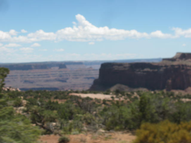
Phenomenal RED Buttes & Mesas .... and not even there yet.
Not even there & it's getting good. I mean Phenomenaly good! I am a RockHound,... , a frustrated wannabe Geologist that loves all the earth & studying the strata.
There are already Alahambra rock formations... Rock that rises as dark brown Monoliths. Alhambra is an "Ignieous Plug" ... Hardd Volcanic melted rock that have pushed up through this Sandstone layered basin... When the Sandstone is eroded,... it makes the Mesa Strata so beautiful. & the Volcanic Plug is left standing as a rock tower or chimney.
Mesa Buttes are towering as visability is 40, maybe 50 miles of this Colorado Plateau.
The Green River meets up w/ the Colorado River and carve into this landscape that has sheer dropoffs from cliffs / mesa ledges / buttes.
Grand view point is 6,000' Elev. Within a couple miles the Green River and Colorado River have carved not only a valley floor 1,000' lower... but then cut a river gorge 1,000' more lower in a Gooseneck mature river erosion pattern. This is what I came for; to see this and revel in it's aura.
Island in the sky. upheavel dome is 5, 760' elev. Mesa buttes & canyons together.... WOW. Green river meets up w/ Colorado river to form a " Y " in park & colorado from there on. 1,000 ft mesas,.... valley floor ...
& 800 to 1,000 ft canyon cut by river. all iside of a couple miles... a geologic
microscope to see in one place. Hiked in 102+ heat & made everybody over 60
proud. lot of water . Nociums / timy bugs eating away. was used to them from
Parris Island ~ they don't eat much. Must have danced hard cause we brought rain
from some clouds / isolated showers.
Clouds moved insome for some great pics. May have been Virga; Rain evaporating before it hits the ground.
What a day. Thank you Lord! this place was some of your best work.


ITW 29 Canyonlands Nat Park Moab Utah
Sunday June 6 2010 8am 85*
Hwy 191 N about 10 miles & Left/ west on Hwy 313
Phenomenal RED Buttes & Mesas .... and not even there yet.
Not even there & it's getting good. I mean Phenomenaly good! I am a RockHound,... , a frustrated wannabe Geologist that loves all the earth & studying the strata.
There are already Alahambra rock formations... Rock that rises as dark brown Monoliths. Alhambra is an "Ignieous Plug" ... Hardd Volcanic melted rock that have pushed up through this Sandstone layered basin... When the Sandstone is eroded,... it makes the Mesa Strata so beautiful. & the Volcanic Plug is left standing as a rock tower or chimney.
Mesa Buttes are towering as visability is 40, maybe 50 miles of this Colorado Plateau.
The Green River meets up w/ the Colorado River and carve into this landscape that has sheer dropoffs from cliffs / mesa ledges / buttes.
Grand view point is 6,000' Elev. Within a couple miles the Green River and Colorado River have carved not only a valley floor 1,000' lower... but then cut a river gorge 1,000' more lower in a Gooseneck mature river erosion pattern. This is what I came for; to see this and revel in it's aura.
Island in the sky. upheavel dome is 5, 760' elev. Mesa buttes & canyons together.... WOW. Green river meets up w/ Colorado river to form a " Y " in park & colorado from there on. 1,000 ft mesas,.... valley floor ...
& 800 to 1,000 ft canyon cut by river. all iside of a couple miles... a geologic
microscope to see in one place. Hiked in 102+ heat & made everybody over 60
proud. lot of water . Nociums / timy bugs eating away. was used to them from
Parris Island ~ they don't eat much. Must have danced hard cause we brought rain
from some clouds / isolated showers.
Clouds moved insome for some great pics. May have been Virga; Rain evaporating before it hits the ground.
What a day. Thank you Lord! this place was some of your best work.